33 Britons Missing After Catastrophic Nepal Flood as Experts Reveal the Terrifying Glacier Collapse Behind Himalayan Disaster
🚨 33 BRITS ARE AMONG THE MISSING — AND EXPERTS SAY THE HIMALAYAN DISASTER BEGAN HIGH ABOVE THEM.
A wall of ice, rock, mud and water suddenly tore through valleys at terrifying speed, wiping out roads, bridges and entire communities — while British families desperately waited for news of loved ones.
But the most chilling discovery came from above: the “earthquake” people thought triggered the disaster may never have been an earthquake at all. Something enormous collapsed from the glacier, turning a mountain valley into a deadly torrent in minutes. 👇
🔥 Now experts are warning that the Himalayas may be becoming even more unstable.
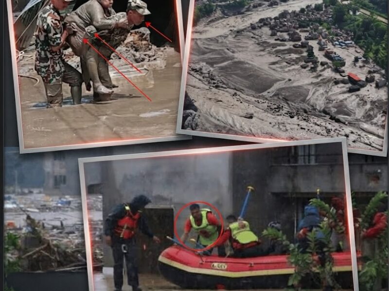
At least 33 British nationals are among the people still missing after a catastrophic flash flood tore through the Nepal-Tibet border region, leaving hundreds dead and vast areas of the Himalayas buried beneath mud, rock and debris.
The disaster began on August 26 in Nepal’s Rasuwa district, close to the border with China’s Tibet Autonomous Region.
What followed was not a conventional rainstorm or gradually rising river.
Instead, an enormous mass of ice and rock collapsed high in the mountains and unleashed a rapidly accelerating torrent down the valleys below.
By August 28, reports from the region put the combined death toll at roughly 390 people, with more than 1,300 others still unaccounted for across Nepal and Tibet. The exact totals remain fluid because communication networks have been badly damaged and authorities are still reconciling figures from different areas.
Among the missing are at least 33 British nationals, according to Nepalese tourism officials.
Their disappearance has prompted an anxious search involving Nepalese authorities, international governments, tour operators and desperate relatives trying to establish whether loved ones survived.
And as rescuers work through the wreckage, scientists have been reconstructing what happened thousands of metres above them.
Their findings have revealed a frightening explanation for why the flood arrived with such extraordinary force.
At least 33 Britons are missing
The British connection to the disaster quickly became apparent as authorities began compiling lists of tourists and pilgrims who could no longer be contacted.
Nepal’s Tourism Board reported at least 33 British nationals among the missing.
They were not necessarily travelling as one group.
The missing included tourists, trekkers and pilgrims who had been travelling through the mountainous region toward Tibet and the sacred Mount Kailash area.
A 13-year-old British girl was among those reported missing, according to British media.
The scale of the international disappearance has made the rescue operation particularly complicated.
Nepalese authorities reported hundreds of foreign tourists among those whose whereabouts remained unknown, including nationals from India, the United States, Ukraine, Australia, Canada and Malaysia.
One Nepalese tourism report put the number of tourists still out of contact at 590, including 476 foreigners.
Britain’s 33 missing nationals were therefore only one part of a much larger international emergency.
The UK government has acknowledged the crisis and said it is working with authorities to support affected British citizens and their families. Prime Minister Andy Burnham urged Britons in the region to follow local authorities’ instructions and the UK’s travel advice.
For families waiting thousands of miles away, however, the biggest problem has been obtaining reliable information.
The flood arrived with almost no conventional warning
The terrifying feature of this disaster is how quickly it developed.
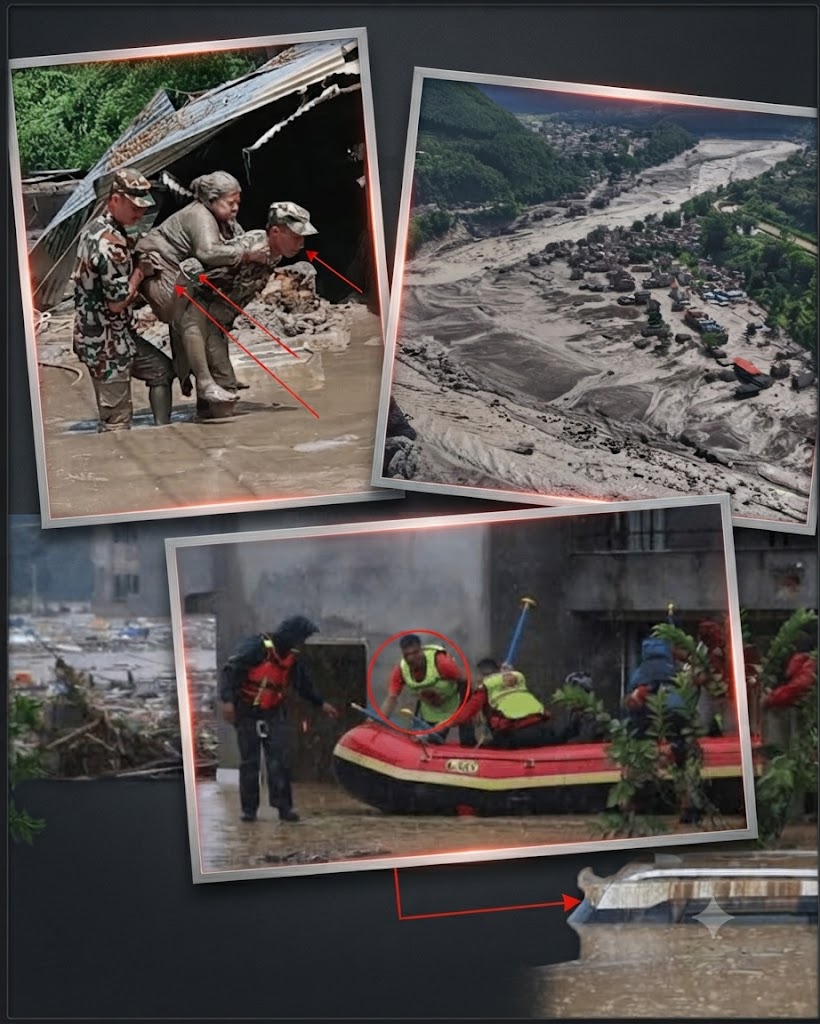
Residents downstream described what appeared to be an enormous wall of water, mud and debris suddenly racing through the valleys.
In some areas, roads disappeared.
Bridges were swept away.
Buildings were submerged or crushed.
Vehicles were carried downstream.
Entire sections of infrastructure were buried beneath sediment.
The Trishuli River system became heavily swollen and clogged with debris, while water levels reportedly rose by as much as nine metres in only about 30 minutes in parts of the affected area.
That speed helps explain why people who were only a short distance from the river sometimes had virtually no time to escape.
This was not simply a case of water gradually overflowing its banks.
It was a cascading geological event.
Scientists initially thought an earthquake was involved
In the immediate aftermath, reports suggested that an earthquake may have triggered the disaster.
That theory seemed plausible.
People reported powerful shaking, while early reports referenced seismic activity around the time of the flood.
But further analysis changed the picture dramatically.
The US Geological Survey determined that there had been no conventional tectonic earthquake responsible for the disaster.
Instead, the enormous collapse of ice and rock itself generated seismic waves.
In other words, what people experienced as earthquake-like shaking was actually part of the mountain collapsing.
That distinction is crucial.
The earthquake did not cause the flood.
The collapse caused both the seismic signal and the flood.
The mountain itself appears to have failed
Satellite imagery has provided some of the clearest evidence yet.
Before-and-after images examined by scientists show a dramatic change in the landscape around the affected river system.
A section of glacier associated with the Langtang Lirung area appears to have collapsed together with underlying rock.
That created a huge landslide containing ice, boulders, sediment and water.
Once the material entered the narrow mountain valleys, it began moving downstream.
And it did not remain a simple landslide.
It transformed into a powerful debris flow.
Experts describe the process as something resembling a river of concrete — except that the “concrete” was moving downhill carrying boulders, trees, vehicles and structures with it.
Simon Cox, a principal scientist at GNS Science in New Zealand, explained that a large piece of glacier may have fallen from an elevation of around 5,200 metres before transforming into a raging mass of debris.
That transformation is one of the reasons the destruction was so widespread.
Why ice and rock can become so destructive
A normal landslide is already dangerous.
But when enormous quantities of ice, rock and sediment enter a river system simultaneously, the consequences can be much worse.
The material effectively loads the water with debris.
That increases its destructive power.
Instead of a relatively clean surge of water, downstream communities are struck by a dense mixture containing boulders, mud, trees and broken infrastructure.
As it moves through narrow Himalayan valleys, the flow can accelerate and become channelled into an even more concentrated torrent.
By the time it reaches populated areas, it can behave less like a traditional flood and more like a moving wall of solid material.
That helps explain the extraordinary destruction visible in satellite images.
Roads were buried.
Buildings disappeared.
Hydropower infrastructure was damaged.
A major border crossing was devastated.
And communities downstream were suddenly confronted with a landscape they barely recognized.
The Himalayas create a particularly dangerous environment
The geography of the region makes events like this especially dangerous.
The Himalayas are among the steepest and most geologically active mountain environments on Earth.
Villages, roads and tourist routes often occupy narrow valleys because those are some of the few areas where development is possible.
That creates a dangerous relationship between mountains and people.
When something collapses high above a valley, the energy has very few places to go.
It is funnelled downhill.
The same geography that makes Himalayan landscapes spectacular for tourists also makes them vulnerable to cascading natural disasters.
Experts have repeatedly warned that the region contains numerous glaciers, unstable slopes and glacial lakes capable of producing sudden floods.
Climate change is part of the growing concern
Scientists have been careful not to claim that climate change definitively caused this specific collapse.
That distinction is important.
A single glacier collapse cannot automatically be attributed to global warming.
But researchers say the broader climate trend is concerning.
Rising temperatures are causing glaciers to retreat in many parts of the Himalayas.
At the same time, warming can contribute to the destabilization of ice, rock and frozen ground at high elevations.
The result is a landscape that may become increasingly prone to rockfalls, landslides, avalanches and glacial flooding.
Nature reported that glacier loss in the Langtang region has accelerated dramatically over the decades, while researchers warn that continued warming could make high-altitude terrain increasingly unstable.
The scientific picture is therefore more complicated than simply saying “climate change caused the flood.”
A more accurate conclusion is that a warming climate may be increasing the background vulnerability of Himalayan mountain systems, while the immediate trigger appears to have been a massive ice-and-rock collapse.
This was not necessarily a glacial lake outburst flood
Another important distinction has emerged.
Some early explanations focused on a glacial lake outburst flood, or GLOF — a sudden release of water stored behind a natural ice or sediment dam.
Such events have caused devastating floods elsewhere in the Himalayas.
But the evidence surrounding this particular disaster increasingly points toward an ice-rock avalanche and glacier collapse as the immediate trigger.
Experts continue to examine exactly how much water, ice and sediment were involved and how the flow developed.
The broad picture, however, is becoming clearer: the catastrophe began high on the mountain before rapidly evolving into a debris-filled flood downstream.
A second flood threat is now worrying authorities
Perhaps the most alarming development is that the original disaster may not be the end of the danger.
The collapse and resulting debris have altered river channels and created blockages in parts of the region.
Those blockages can act like temporary natural dams.
Water accumulates behind them.
If the barrier suddenly fails, another flood wave could rush downstream.
Authorities have warned communities in vulnerable areas to remain alert and move to safer ground where instructed.
Reports have described a large volume of water accumulating behind debris in the region, raising concerns that another sudden release could produce additional flooding.
For rescuers, this creates a nightmare scenario.
They are trying to search for missing people while simultaneously working in terrain that could shift again.
Every helicopter flight, road-clearing operation and riverbank search therefore carries additional risks.
The international rescue effort
Nepal has mobilized military and police personnel for the rescue operation.
Helicopters have been used to evacuate survivors and deliver supplies to communities cut off by destroyed roads and bridges.
The damage to communications infrastructure has complicated the search.
Families may know that a relative was in the region but have no way of confirming whether they survived.
Tour companies have also been attempting to account for their clients.
One tour operator, Himalayan Glacier, reported losing contact with dozens of people from one group, including foreign tourists.
International governments have joined the effort by providing consular support and coordinating information about missing nationals.
For Britain, the presence of at least 33 missing citizens has made the disaster a particularly urgent diplomatic and humanitarian issue.
Why the tourist routes became a death trap
The affected region is not simply remote wilderness.
It is an important route for tourism, trekking and pilgrimage.
Mount Kailash, across the border in Tibet, is one of Asia’s most important religious sites.
Pilgrims travel through some of the most challenging terrain on Earth to reach it.
That means the people caught in the disaster included experienced travellers as well as ordinary pilgrims and tourists.
Many had no reason to expect that a mountain hundreds or thousands of metres above them could suddenly unleash a wall of debris.
That is one of the most frightening lessons from the disaster.
There may have been no conventional rainfall warning capable of signalling what was coming.
A ‘blue-sky’ disaster
Researchers have described the event as resembling what engineers might call a “blue-sky flood” — a catastrophic flood that develops even when traditional weather indicators do not provide an obvious warning.
The University of Ottawa’s analysis noted that there were apparently no preceding signs such as extreme rainfall or a steadily rising river that would normally trigger a conventional flood alert.
The mountain itself produced the warning signal.
But the problem was recognizing what that signal meant.
The seismic disturbance caused by the collapse could potentially be detected.
Yet a system designed primarily to identify conventional earthquakes or river flooding may not immediately translate that signal into a warning that a massive debris flow is about to enter a populated valley.
That is a major challenge for future disaster preparedness.
What experts are watching now
Scientists and authorities are now monitoring the altered river systems and unstable slopes for signs of further collapse.
The immediate priorities remain straightforward: find survivors, locate missing people, evacuate threatened communities and restore communications.
But the longer-term questions are much larger.
Can early-warning systems be designed to detect glacier collapses before the resulting debris flow reaches populated areas?
Can satellite monitoring identify unstable sections of glaciers quickly enough?
Can communities living downstream be given evacuation warnings within minutes rather than hours?
And how should governments prepare as warming temperatures continue to change the stability of high-altitude environments?
The Nepal disaster has turned those questions from scientific concerns into urgent human ones.
The search for the missing continues
For the families of the 33 missing Britons, scientific explanations offer little comfort while their relatives remain unaccounted for.
Among the missing are pilgrims, tourists and young people who were simply travelling through one of the world’s most spectacular regions.
Their families are now waiting for news while rescuers work through valleys transformed by mud and rock.
The death toll has already approached 400, and the final number could rise as isolated areas become accessible.
But perhaps the most haunting aspect of the disaster is the realization that the catastrophe did not begin where most victims experienced it.
It began high above them.
A section of ice and rock gave way on a Himalayan slope.
That collapse generated its own seismic shock.
The falling material entered the river system.
And within minutes, an enormous torrent of mud, water, ice and rock was racing toward communities and travel routes below.
The disaster serves as a brutal reminder that in the Himalayas, the greatest danger may sometimes come from a mountain that appears completely still.
And with at least 33 Britons still missing, hundreds of others unaccounted for and warnings of additional flooding, the nightmare is not yet over.
The search continues — but so does the question scientists are now asking: if one glacier collapse can unleash this much destruction without the warning signs of a conventional flood, how many other unstable Himalayan slopes could be waiting to fail?